Blue Ridge Parkway
The Blue Ridge Parkway makes its way through the heart of Virginia's Blue Ridge Mountains. At 469 miles, this scenic drive winds along the Blue Ridge Mountains and offers visitors the opportunity to enjoy some of the best mountain views in the world.
The Parkway is operated by the National Park Service and is the most visited unit in the National Park System.
Travelers can take the Parkway north out of the Roanoke Valley and make their way to Shenandoah National Park and Skyline Drive or south toward Great Smoky Mountains National Park and Grandfather Mountain in North Carolina.
The Blue Ridge Parkway also connects you to interesting locations in Virginia's Blue Ridge. The Parkway is only a 10-minute drive from Downtown Roanoke and there are eight different entry points to this world-famous road throughout the region.
When traveling on the Blue Ridge Parkway, visitors have the opportunity to enjoy a variety of experiences, including Mabry Mill - one of the most photographed spots on the Parkway and an icon of the region, as well as Explore Park and the Peaks of Otter.
The following resources can help you plan your time on this historic landmark that has been named "America's Favorite Drive."
Blue Ridge Parkway Map
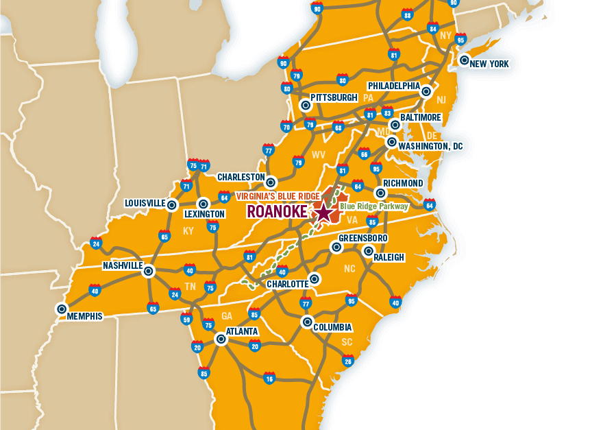
Navigate your way along the Blue Ridge Parkway using the map below or this Roanoke Valley Parkway Map, which includes the key points of entry to the Parkway from Virginia's Blue Ridge. Take advantage of the Interactive Map and other resources on the Blue Ridge Parkway website to enhance your drive.

Blue Ridge Parkway Camping
Camping on the Blue Ridge Parkway presents an exciting outdoor adventure in Virginia's Blue Ridge. These campgrounds in our region are located within close proximity of the Parkway:
- Explore Park Camping & Cabins - Milepost 114
- Peaks of Otter Campground - Milepost 86
- Rocky Knob Campground - Milepost 167
Blue Ridge Parkway Biking
Check out our Blue Ridge Parkway Biking page for learning more about the ways you can enjoy America's Favorite Drive on two wheels!
Blue Ridge Parkway Hiking
The Blue Ridge Parkway offers more than just an incredible drive - it's also home to some fantastic trails. Visit some of the most popular hiking trails on the Parkway in Virginia's Blue Ridge:
See a complete list of hiking trails on the Blue Ridge Parkway in Virginia.
Blue Ridge Parkway Lodging
After a full day of driving on the Blue Ridge Parkway, take advantage of the many overnight accommodations available in Virginia's Blue Ridge. Some comfortable places near the Parkway to rest for the night are:
Blue Ridge Parkway Motorcycle Rides
The Blue Ridge Parkway is one of the best routes in the Roanoke Region in Virginia's Blue Ridge for a motorcycle ride. Travel north on the Parkway from Roanoke to the Peaks of Otter and enjoy beautiful views of Purgatory Mountain, Mills Gap, and Iron Mine Hollow.
You can also travel south on the Parkway from Roanoke and visit iconic locations such as Mabry Mill, Rocky Knob Recreation Area, and the Town of Floyd.
KNOW BEFORE YOU GO: Please drive with caution and familiarize yourself with the National Park Service guidelines regarding Motorcycle Safety on the Blue Ridge Parkway.
Blue Ridge Parkway Closures
Due to occasional construction projects and inclement weather, portions of the Blue Ridge Parkway are forced to close. Fortunately, the National Park Service maintains updated information about closures on the Parkway on its website.
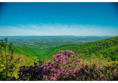
Blue Ridge Parkway - Views
Virginia's Blue Ridge Region, VAMap Details
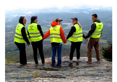
Friends of the Blue Ridge Parkway
541 Luck Ave. SW #317Roanoke, VA 24016
Map Details
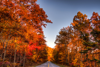
Enjoy beautiful views around every turn along these amazing scenic drives in Virginia's Blue Ridge!