The Roanoke Valley in Virginia's Blue Ridge boasts a special kind of flavor and the culture of the region is reflected in the outstanding tastes of the cuisine.

FAQs about Virginia's Blue Ridge
This website is meant to serve as a valuable resource for you with extensive information about the Roanoke Valley in Virginia's Blue Ridge Mountains, and there are a few questions we frequently get asked that deserve some special attention.
See below to learn the answers to the most frequently asked questions about Virginia's Blue Ridge.
What makes the Blue Ridge Mountains blue?
Is this the Lost Colony of Roanoke?
What is the story behind the big star on top of the mountain?
Where is the Blue Ridge Parkway?
Are there large bodies of water in the area?
What kind of weather do you have in Virginia's Blue Ridge?
When is the best time to visit?
What makes the Blue Ridge Mountains blue?
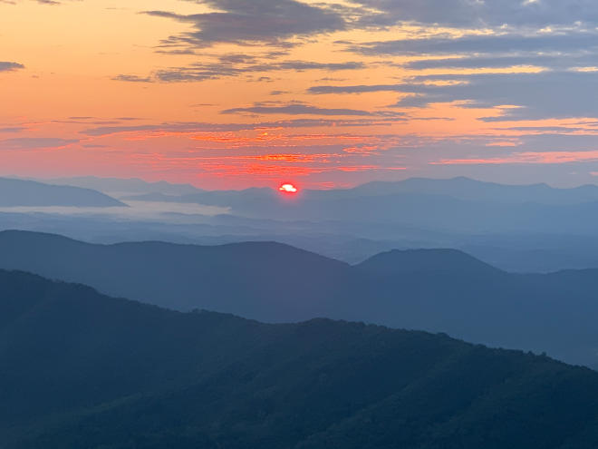
It's a rather complicated explanation of physics and biology, but we won't bore you with all the details. Basically, the trees that cover the Blue Ridge Mountains release organic compounds into the air.
When those compounds and tiny particles from the trees and plants are released, it creates a blue haze that gives our mountains their distinct blue color.
Is this the Lost Colony of Roanoke?
 No. The Lost Colony of Roanoke was on Roanoke Island in Eastern North Carolina near the coast. The colony was established by the English in 1585 and was later found deserted when English explorers returned to Roanoke Island in 1590.
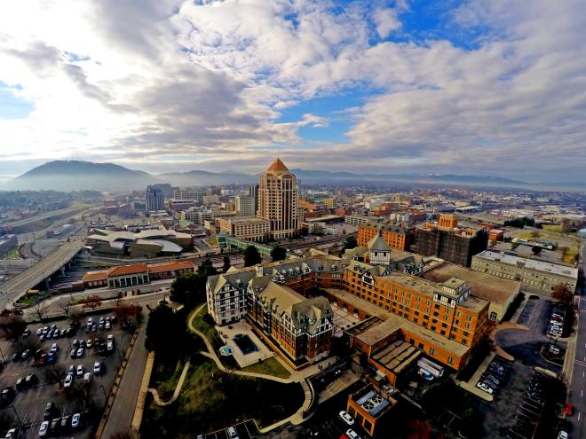
The Roanoke in Virginia's Blue Ridge was originally known as "Big Lick," which was because of the area's large deposits of salt in the Roanoke River. The town of "Big Lick" was established in 1852 and chartered in 1874, and the name was changed to "Roanoke" in 1882, which comes from the Algonquin word for shell money, "Rawrenock."
Roanoke grew as a railroad and coal hub, eventually becoming the transportation center of western Virginia.
What is the story behind the big star on top of the mountain?
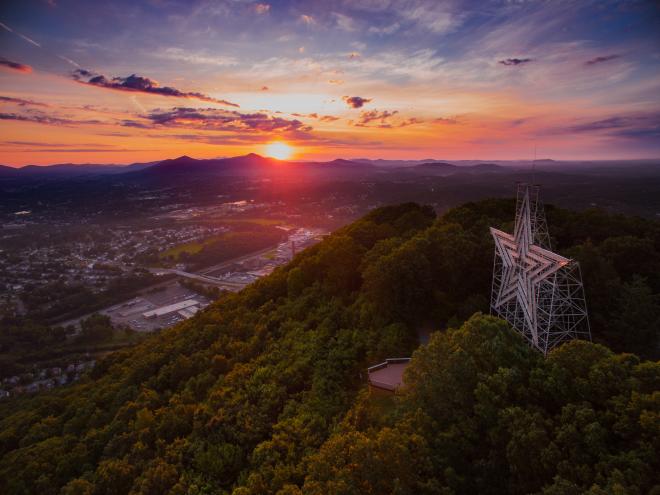
The Roanoke Star sits atop Mill Mountain and serves as an iconic symbol that overlooks the Roanoke Valley and shines brightly at night. The star was constructed in 1949 and was meant to serve as a Christmas decoration for the region that would be taken down following the holiday season of 1949.
However, the neon star was such a popular symbol that the city elected to keep it atop the mountain, where it remains today.
How many people live here?
Based on the most recent census data, the region is home to approximately 300,000 people. The Roanoke Metropolitan Statistical Area includes the City of Roanoke, City of Salem, Roanoke County, Botetourt County, Craig County and Franklin County.
The City of Roanoke is the most populated area of the region with approximately 100,000 residents.
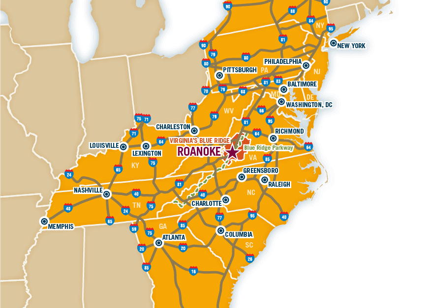
Where is the Blue Ridge Parkway?
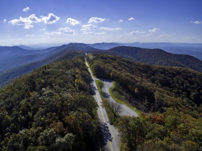
The Blue Ridge Parkway winds through the heart of Virginia's Blue Ridge in a north/south direction and the region features eight primary entry/exit points to reach this breathtaking road that's been named "America's Favorite Drive."
The Parkway passes through Floyd County, Franklin County, Roanoke County, Botetourt County and Bedford County in Virginia's Blue Ridge, and can be easily reached from many different parts of the region.
See our Blue Ridge Parkway Map for helpful information.
Are there large bodies of water in the area?
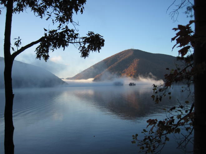
Virginia's Blue Ridge is home to Smith Mountain Lake, Virginia's 2nd largest lake. Smith Mountain Lake features over 500 miles of glistening shoreline and is located in the eastern part of the region.
We also have a variety of rivers that provide wonderful opportunity for fishing, kayaking, canoeing and more. The Roanoke River, Blackwater River and James River are all primary rivers in Virginia's Blue Ridge.
Plus, Carvins Cove Natural Reserve is located on over 12,000 acres of land in Roanoke & Botetourt County and provides an incredible assortment of outdoor activities.
What kind of weather do you have in Virginia's Blue Ridge?
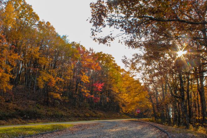
The region is in a location where it experiences four distinct seasons. The higher elevations prevent Virginia's Blue Ridge from reaching sweltering summer temperatures, but it's far enough south to experience mild winters.
The average annual temperatures are a high of 67F and low of 45F, with an average annual rainfall of 40.3 inches and annual snowfall of 22.8 inches and 118 precipitation days.
Virginia's Blue Ridge is also located in an ideal position to experience the breathtaking beauty of fall foliage in the Blue Ridge Mountains, which is usually in October and November.
When is the best time to visit?
It's impossible to only pick one time of year to visit the Roanoke Valley in Virginia's Blue Ridge. Because of our mild temperatures and great variety of activities, any of the four seasons can provide a wonderful opportunity for a mountain getaway.