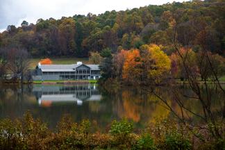
Find the perfect place to relax at these overnight accommodations located near the Blue Ridge Parkway.
Blue Ridge Parkway Repair Projects
Portions of the Blue Ridge Parkway in the Roanoke Region are undergoing repairs for pavement reconstruction and other safety measures. Visit the National Park Service website for current road status and repair updates. Learn More

-
Things To Do
- Arts & Culture
- Attractions
- Beer, Wine & Spirits
- Blue Ridge Parkway
- Events
- Free Things To Do
- History & Heritage
- Kid Friendly
- Nightlife
-
Outdoor Adventure
- Leave No Trace
- Trail Guidelines
- Appalachian Trail
- Biking
- Climbing
- Disc Golf
- Fall Color Spots
- Fishing
- Geocaching
- George Washington & Jefferson National Forests
- Greenways
- Hiking Trails
- Horseback Riding
- Kayaking & Paddling
- Kid Friendly Outdoors
- Motorcycle Touring
- Outdoor Outfitters & Shops
- Scenic Drives
- Water Sports
- Wildlife Viewing & Birding
- Classes & Workshops
- Sample Itinerary
- Sample Itineraries
- Shopping
- Spas
- Sports
- Tours
- VBR Savings Pass
- Hotels/Lodging
- Restaurants
- Region
- Plan
Search
Blue Ridge Parkway Map
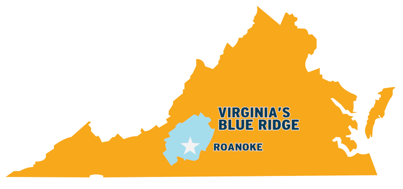
This Blue Ridge Parkway map indicates the many convenient access points in the Roanoke Region in Virginia's Blue Ridge.
This scenic road passes through many popular points of interest in the region and can be easily reached from various locations.
View Blue Ridge Parkway Map in a larger map
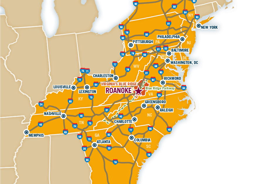
The above map features the entry points to the Blue Ridge Parkway in Virginia's Blue Ridge.
Navigate the map using the zoom feature in the bottom right corner to pinpoint an exact location for entering and exiting the Parkway.
Starting from the south and moving north along the map, the following list details the eight primary entry/exit points to the Blue Ridge Parkway in Virginia's Blue Ridge.
Milepost 165 - Virginia Route 8
Route 8 leads north to the Town of Floyd and its art studios, galleries, colorful specialty shops, popular restaurants, fresh local food, and music venues with live mountain and roots music, including the iconic Floyd Country Store.
Milepost 136 - U.S. Route 221
The exit at Milepost 136 provides easy access to U.S. Route 221 in Roanoke County and neighboring Franklin County. U.S. Route 221 is an alternative route for reaching the City of Roanoke.
Milepost 121 - U.S. Route 220
U.S. Route 220 is conveniently located near many great accommodations, shopping, and dining options in South Roanoke, as well as Explore Park and the Blue Ridge Parkway Visitor Center. It also offers easy access to Interstate 581 and Interstate 81.
Milepost 120 - Mill Mountain Parkway
The exit at Milepost 120 for Mill Mountain Parkway offers the most convenient access to Downtown Roanoke. This exit also leads to the Roanoke Star and Overlook, Discovery Center, and Mill Mountain Zoo, located atop Mill Mountain.
Milepost 112 - Virginia Route 24
The Parkway and Route 24 junction provide the nearest access to Smith Mountain Lake via Routes 24 and 122. This exit is also near the charming shopping, restaurants, and events in the Town of Vinton.
Milepost 106 - U.S. Route 460
U.S. Route 460 connects the Roanoke Valley to the northeast communities of Bedford, Lynchburg, and Appomattox. The exit at Milepost 106 is nine miles east of Roanoke and 21 miles west of Bedford. Many restaurants and shops are located near this exit in the Bonsack community. During the fall trips, this access point also provides convenient access to the fall activities at Jeter Farm.
Milepost 90 - Virginia Route 43
The Town of Buchanan is located only four miles north of the Parkway exit at Milepost 90 for Route 43. Downtown Buchanan offers wonderful antiquing, B&Bs, dining, access to the James River, and more. This exit is also an excellent spot for connecting back with Interstate 81, located near Buchanan.
Milepost 86 - Peaks of Otter & Virginia Route 43
Virginia Route 43 connects to the Blue Ridge Parkway at the Peaks of Otter. Travel east on Route 43 to reach the Town of Bedford, home to the National D-Day Memorial.
Click here to download a complete map of the Blue Ridge Parkway from the National Park Service.
This downloadable map also focuses on the Blue Ridge Parkway and the area around the Roanoke Valley.
In This Section
Roanoke Region Spotlight
Want the latest on Virginia’s Blue Ridge? Securely sign up for our FREE e-newsletter:
Visit Virginia's Blue Ridge 101 Shenandoah Avenue NE Roanoke, VA 24016 (540) 342-6025 (800) 635-5535
Visit Virginia’s Blue Ridge is committed to cultivating an atmosphere that welcomes and celebrates the unique backgrounds, abilities, passions, and perspectives of our vibrant community. As our region’s only destination marketing organization, we have a responsibility to showcase the best the Roanoke Region has to offer, and those assets and strengths come in varied forms. We embrace differences in race, religion, sexual orientation, gender, gender identity or expression, language, visible and invisible disabilities, and all the intersecting identities that make Virginians and visitors alike so unique. We believe our differences make us stronger– and better.

close